Long before a building is constructed, before any ribbon cutting, steel erection, concrete pour, or even the ground breaking ceremony, all you have is a site. And before any part of construction can begin, you have to get to know your site – its boundaries, its hills and valleys, and all its existing utilities and features.
That’s where a land surveyor comes in.
Surveyors are the starting point of almost any construction project and are also key team members throughout the building process. In recognition of National Surveyors Week and to shine a spotlight on the crucial roles surveyors play in the design and construction process, we caught up with Wallace’s licensed surveyor, Lee Martin, PE, PLS.
Surveying Basics
Land surveying is the process of determining the position of points or features on a terrain relative to a benchmark, or a point of known location and elevation. Surveyors measure distances and vertical and horizontal angles between points and then calculate the points’ relative positions using geometry and trigonometry.
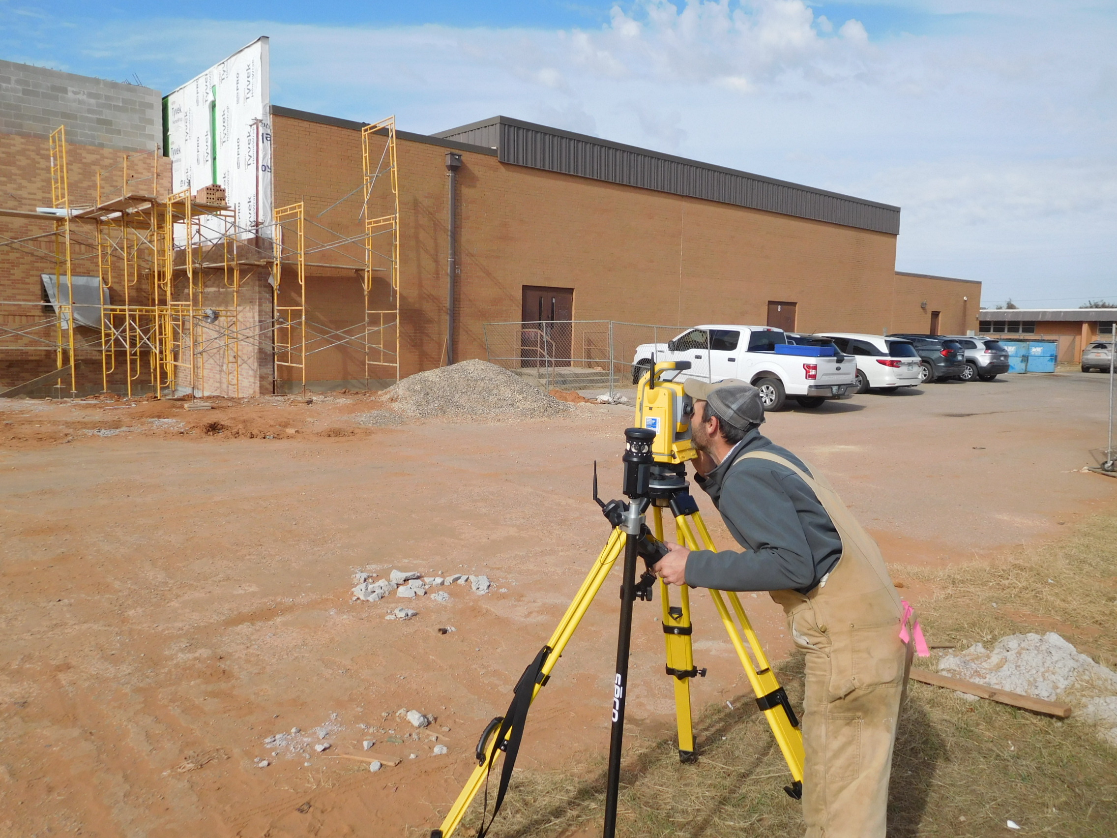
Back in the day, surveyors made measurements using tools such as a compass (horizontal angles), theodolite (vertical and horizontal angles), and Gunter’s chain or steel tape (distances) and did calculations by hand. Today’s surveying equipment includes GPS receivers and the Electronic Total Station (ETS), which can measure angles and distances electronically and provide coordinates (much like the Cartesian x, y, z).
Types of Land Surveying
Surveying is required for everything from cartography to mining to archeology; however, as Martin notes, this profession is a cornerstone of the AEC industry.
“A survey is needed for almost all civil design projects, which makes surveying a great addition and benefit to Wallace’s civil services.”
Architects, engineers, contractors, and owners rely on surveying for verifying site boundaries for permits, recording existing conditions as a starting point for site design, accurately laying out site features during construction, and documenting as-built conditions. These tasks are accomplished through the following types of surveys:
- Topographic survey – Topographic surveys are typically performed to establish elevations across a site and develop contour maps. Additionally, the surveyor records the existing site features, including natural elements, such as streams or trees, and previous improvements, such as fences, utilities, or structures. Topographic surveys are often taken in conjunction with boundary surveys, and the resulting maps are used by architects and civil engineers for site planning.
- Boundary survey – Boundary surveys define the property limits of a site and are important for permits and legal purposes. These types of surveys also locate easements and identify encroachments.
- Construction Survey – Construction surveys help contractors spatially establish the site layout by staking out locations of structures, roads, parking lots, and utilities to match the drawings. Construction surveys can also help define required grading or record as-built conditions.
Land Surveying Process
For Martin’s crew, the basic surveying process for a civil design project begins with a boundary survey to determine the property limits. This is followed by a topographic survey, during which they collect the elevations and information on existing site features.
The team can use GPS receivers or the more conventional ETS to record x, y, and z coordinates across the site. When using an ETS, the surveyor walks the property in a logical pattern while staying within the line of site of the instrument and carrying a rod and device that communicates back to the ETS. At each selected point, the ETS records the coordinates while the surveyor enters a description (back of curb, building, fence, etc).
Back in the office, the survey programs will draw in the grading contour linework in CAD and add the correct point symbols for the existing elements. The software then produces a site map with the grading contours and symbols that is then sent to the civil engineer to be used for design of the site layout.
Surveyors of Yesterday vs Today
Although today’s surveying equipment might look different than that of the ancient Egyptians or Lewis and Clark, the basic principles of the profession, and even quality of results, have not drastically changed. You might think that the technological advances have made surveying supremely more accurate, and in a sense, they have. However, our society is built on centuries of survey data collected without GPS, and the results, from the pyramids to township lines, have served us well. Older, more manual surveying techniques and tools are actually quite accurate in the hands of skilled surveyors. The main difference lies in efficiency. Modern technologies allow today’s surveyors to cover more ground in shorter amounts of time with lighter, more mobile, digital equipment and fewer people.
Just as in past generations, surveying still requires a love of the outdoors, a detail-oriented approach, a fundamental understanding of trig and geometry, and the ability to embrace technology. In addition to enjoying the outdoors and the constant variety of locations, Martin finds great satisfaction in getting to be involved with a project from the very start all the way to the end.
“In general, I think it is rewarding to see and survey a site before development and then when you return for the as-built to see the completed project.”
For Martin, this age-old profession brings new challenges every day. The land survey profession has been around for centuries, and although technologies have evolved, surveying isn’t going anywhere anytime soon. Surveyors have been and will continue to be important players in construction projects from start to finish.

1https://www.gps.gov/systems/gps/performance/accuracy/#:~:text=For%20example%2C%20GPS%2Denabled%20smartphones,receivers%20and%2For%20augmentation%20systems
2https://www.icsm.gov.au/education/fundamentals-mapping/surveying-mapping/surveying-using-gps-and-conclusion


I’m glad you talked about how a land surveyor’s work is to research all about a site. Recently, my cousin mentioned he’s interested in purchasing a piece of land. My cousin’s always wanted to have a farm, and I think that’s his ultimate goal, so I’ll be sure to share this article with him before he makes any purchase. Thanks for the information on land surveying and how it’s a must for any construction.
Thanks for the info about land surveying. I need help with permits and land surveying. I’ll look for a professional who can help me out with land surveying.
Great content!
I was impressed by the range of land surveying services offered by Wallace Design, as well as their commitment to using the latest technology in their work. The site is easy to navigate and provides clear information about the company’s services and expertise.